Maps and Cross-Sections:
Correlations Across Space and Time
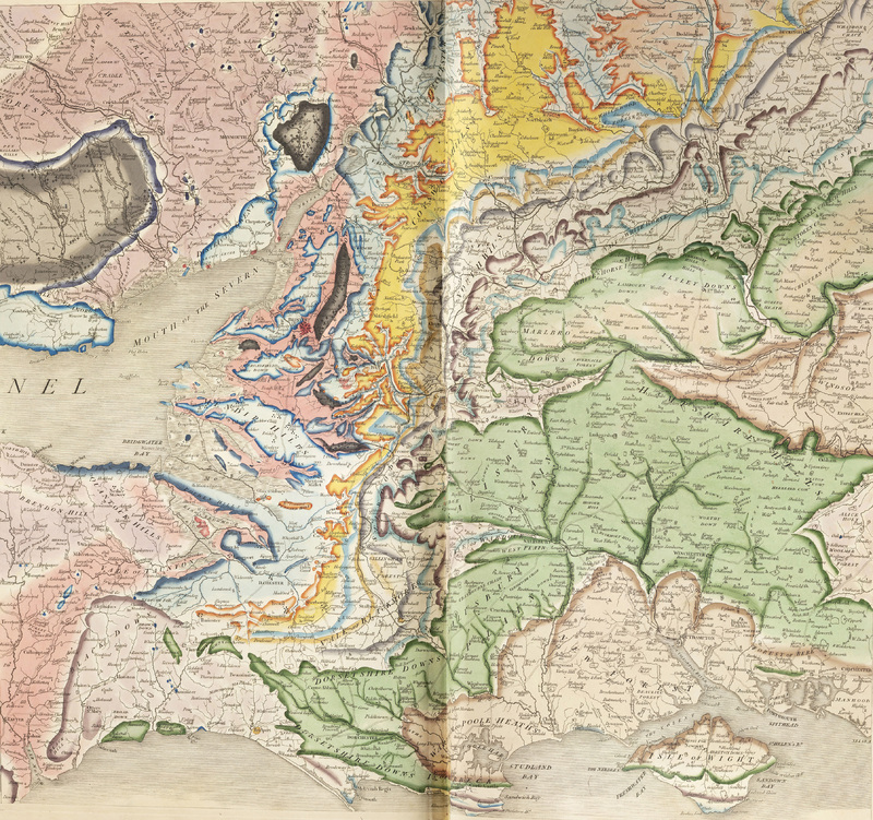
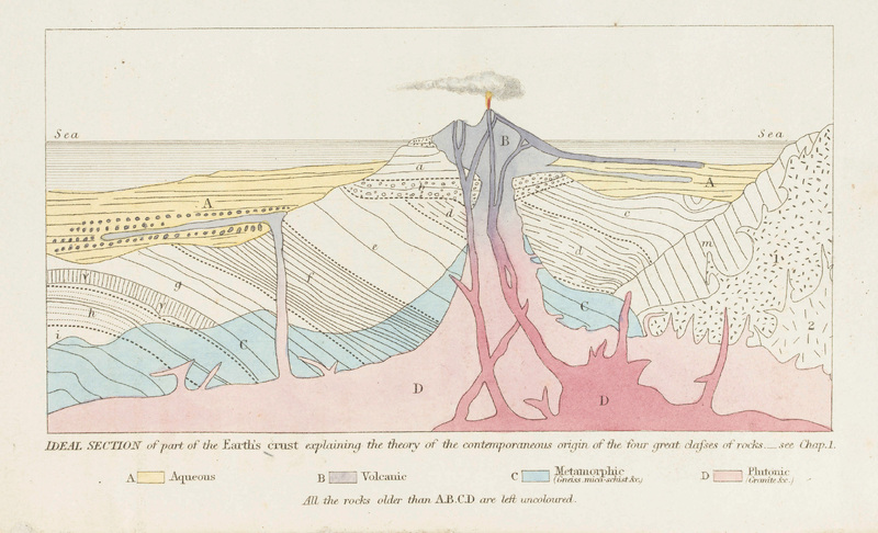
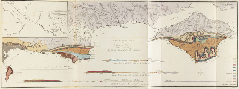
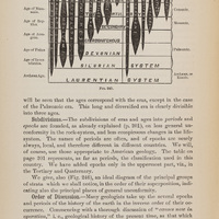
Just as Cuvier and Alexandre Brongniart were enriching the study of Earth’s layers in a specific region (the Paris Basin), other geologists were using the fossil record to correlate distinct rock units across entire countries. This case highlights several examples of the large spatial scales at which savants were applying the newly developed principles of stratigraphic analysis. Their approaches consisted of showing observations in both map views, and in cross-sections: vertical slices through the Earth across great distances.
Works Included
Previous Section:
History in the Layers of the Earth
Next Section: